Swat’s Forgotten Masterpeice
The Yusufzai Plain stretches from the Mahaban Mountains in the north to the line of the Grand Trunk Road, passing through Nowshera and from the Indus in the east just west of Mardan. Of all the districts of Khyber Pakhtunkhwa, Mardan is agriculturally the richest and most prosperous.
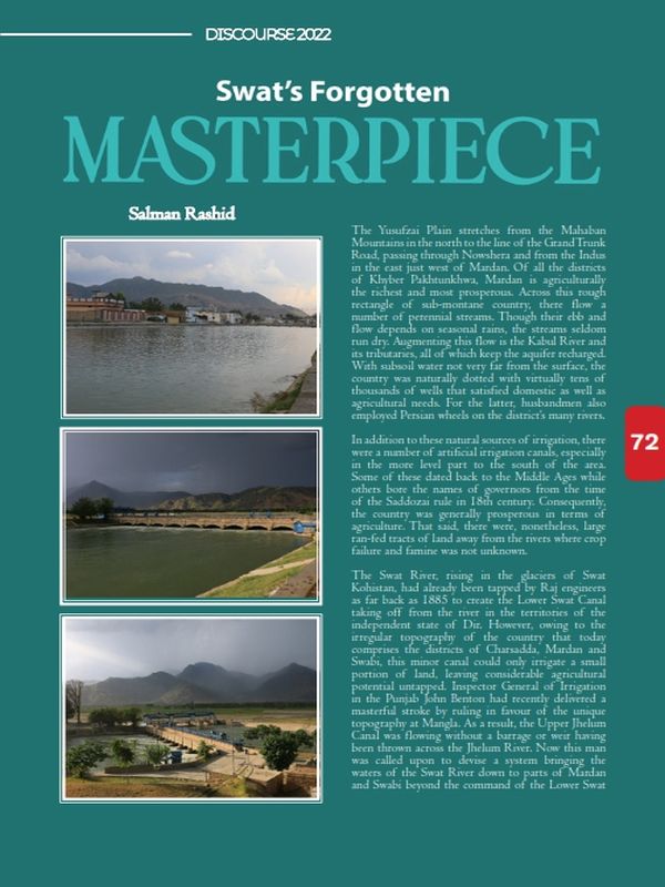
Across this rough rectangle of sub-montane country, there flow a number of perennial streams. Though their ebb and flow depends on seasonal rains, the streams seldom run dry. Augmenting this flow is the Kabul River and its tributaries, all of which keep the aquifer recharged. With subsoil water not very far from the surface, the country was naturally dotted with virtually tens of thousands of wells that satisfied domestic as well as agricultural needs. For the latter, husbandmen also employed Persian wheels on the district’s many rivers.
In addition to these natural sources of irrigation, there were a number of artificial irrigation canals, especially in the more level part to the south of the area. Some of these dated back to the Middle Ages while others bore the names of governors from the time of the Saddozai rule in 18th century. Consequently, the country was generally prosperous in terms of agriculture. That said, there were, nonetheless, large ran-fed tracts of land away from the rivers where crop failure and famine was not unknown.
The Swat River, rising in the glaciers of Swat Kohistan, had already been tapped by Raj engineers as far back as 1885 to create the Lower Swat Canal taking off from the river in the territories of the independent state of Dir. However, owing to the irregular topography of the country that today comprises the districts of Charsadda, Mardan and Swabi, this minor canal could only irrigate a small portion of land, leaving considerable agricultural potential untapped.
Inspector General of Irrigation in the Punjab John Benton had recently delivered a masterful stroke by ruling in favour of the unique topography at Mangla. As a result, the Upper Jhelum Canal was flowing without a barrage or weir having been thrown across the Jhelum River. Now this man was called upon to devise a system bringing the waters of the Swat River down to parts of Mardan and Swabi beyond the command of the Lower Swat Canal.
Given the topography, it was obvious the river would have to be tapped north of the Malakand Pass in order for the target areas to be watered. Amandarra, just outside Batkhela town, was chosen as the take off point after conducting surveys. Here the Swat River makes a wide arc to the right, forcing its flow to hug the left bank in a narrow channel, a situation identical to the one that Benton had approved at Mangla. A three-gated headworks on this narrow channel was all that was necessary to raise the water level in order to feed into a canal through a regulator.
Not far south of the proposed headworks, however, sat the mountain barrier of the Malakand Pass. Seemingly impassable, the pass could not reign in Benton’s soaring mind. With signature verve, he proposed a tunnel to carry the Swat waters down to the heart of the Yusufzai Plain.
Even as work on the headworks and canal regulator at Amandarra and canal excavation was taken in hand in 1909, G. L. Bill, a mining engineer, set about surveying for the shortest possible alignment for the tunnel. With the experience of building railway tunnels in the subcontinent behind them, British mining engineers were well acquainted with the kind of stratum they were to work in.
Still, digging a three kilometre-long tunnel for a canal was out of the ordinary. This was no railway tunnel where large steam-driven machinery could be trundled in on rails. Rather, it was a much narrower conduit with low clearance and a much sharper fall. Men had to dig in uncomfortably cramped quarters and the trolleys to remove debris could only be rolled in by a derrick placed outside the mouth of the opening. Just as they had come to dig the railway tunnels in distant Balochistan, Kashmiri and Pakhtun miners once again flocked to work under the Malakand Pass.
Almost in lockstep, the headworks, canal as well as the tunnel, named after Benton, were completed on schedule in early 1914. The gates of the regulator were winched up and nearly 2200 cusecs of water flowed into the Upper Swat Canal speeding down the tunnel and into the Yusufzai Plain in time for the final watering of the ripening wheat crop.
Entering the plains near Dargai, Upper Swat Canal swings east to sweep the Mahaban foothills in Swabi district before turning west again to cover its 310,000 acres of culturable land. Though this country was watered by several hill torrents, it had a history of periodic crop failure. Now, for the first time, as the chilled emerald waters of the Swat River flowed into patches of cultivation, the farmers of Mardan and Swabi knew the fear of famine was well behind them.
As time went by a fine web of minor distributaries drew off from the main canal to increase the area under cultivation. As the 20th century drew to a close, rising population and changing cropping patterns warranted greater need for irrigation. To their credit, Pakistani irrigation engineers designed and executed an auxiliary tunnel running next to Benton Tunnel. At its lower end in Mardan district, this new outlet runs an 81 megawatt power station besides raising the current irrigated command of Upper Swat Canal to 2.48 million acres.
When Pakhtun farmers today pride their sugar beet and tobacco for its quality, scarcely anyone of them knows of Sir John Benton, the man who boldly went ahead with plan after innovative plan to enrich their land.
The author is a Fellow at the Royal Geographic Society.
Connect with the Pakistan Institute of Development Economics
Subscribe
Select topics and stay current with our latest insights
- +92 51 9248051
- [email protected]
- PIDE, QAU Campus, Islamabad